|
|
||||||||||||||||||||||||||||||||||||||||||||||||||||||||||||||||||||||||||||||||||||||||||||||||||||||||||||||||||||||||||||||||||
 |
||||||||||||||||||||||||||||||||||||||||||||||||||||||||||||||||||||||||||||||||||||||||||||||||||||||||||||||||||||||||||||||||||
|
Cheviot from Langleeford Via Harthope Burn 8.1 Miles 5.0 hours Location OS Landranger sheet 74 NT 95352255 How to get there From south on the A697. Turn left into Wooler and at the top of the hill take the road left (Cheviot Street) and follow the signposts to Langleeford. follow the single track to a sign advising vehicles are prohibited beyond it. There is room here to park.Download walk instructions Click Here check your downloads folder |
||||||||||||||||||||||||||||||||||||||||||||||||||||||||||||||||||||||||||||||||||||||||||||||||||||||||||||||||||||||||||||||||||
 |
|
|||||||||||||||||||||||||||||||||||||||||||||||||||||||||||||||||||||||||||||||||||||||||||||||||||||||||||||||||||||||||||||||||
|
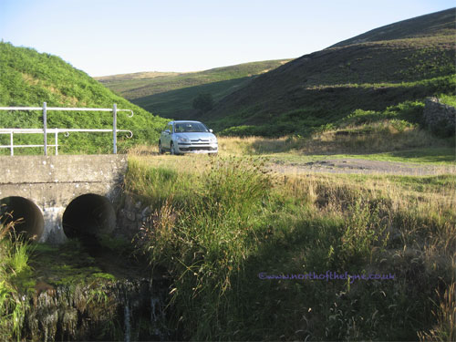
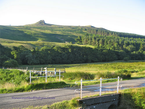
Start The walk commences from this bridge and follows the roadway past Langleeford (1Km) which is seen down to your left. Having gone around the cottages at Langleeford Hope some 2Km further on it follows the Harthope Burn for about another 2.5Km before making its right turn up Cheviot.
|
||||||||||||||||||||||||||||||||||||||||||||||||||||||||||||||||||||||||||||||||||||||||||||||||||||||||||||||||||||||||||||||||||
 |
 |
|||||||||||||||||||||||||||||||||||||||||||||||||||||||||||||||||||||||||||||||||||||||||||||||||||||||||||||||||||||||||||||||||
 |
 |
|||||||||||||||||||||||||||||||||||||||||||||||||||||||||||||||||||||||||||||||||||||||||||||||||||||||||||||||||||||||||||||||||
 |
||||||||||||||||||||||||||||||||||||||||||||||||||||||||||||||||||||||||||||||||||||||||||||||||||||||||||||||||||||||||||||||||||
 |
 |
|||||||||||||||||||||||||||||||||||||||||||||||||||||||||||||||||||||||||||||||||||||||||||||||||||||||||||||||||||||||||||||||||
 |
 |
|||||||||||||||||||||||||||||||||||||||||||||||||||||||||||||||||||||||||||||||||||||||||||||||||||||||||||||||||||||||||||||||||
 |
||||||||||||||||||||||||||||||||||||||||||||||||||||||||||||||||||||||||||||||||||||||||||||||||||||||||||||||||||||||||||||||||||
 |
 |
|||||||||||||||||||||||||||||||||||||||||||||||||||||||||||||||||||||||||||||||||||||||||||||||||||||||||||||||||||||||||||||||||
 |
The Harthope Burn
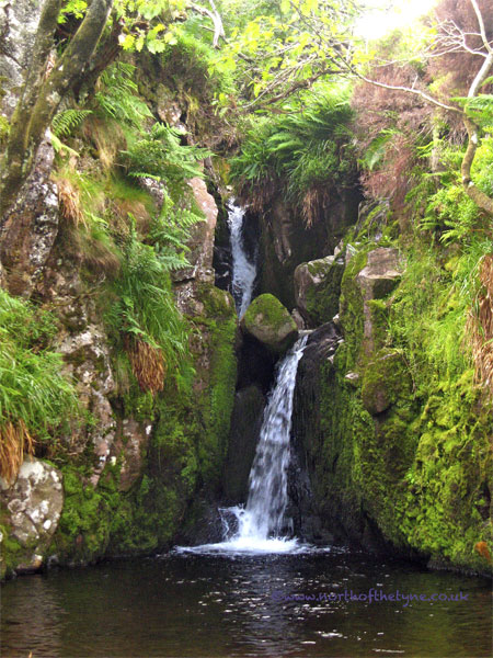
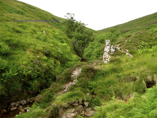
When first encountered the walk is on the right of the Burn but as the path climbs you will be crossing and recrossing from bank to bank. Some of the banks are slippy and in places liable to crumble. so be careful ! I chose this ascent and the early morning so that the sun would be behind me as I made my way up the valley of the Burn. The picture below is of Harthope Linn |
|||||||||||||||||||||||||||||||||||||||||||||||||||||||||||||||||||||||||||||||||||||||||||||||||||||||||||||||||||||||||||||||||
 |
||||||||||||||||||||||||||||||||||||||||||||||||||||||||||||||||||||||||||||||||||||||||||||||||||||||||||||||||||||||||||||||||||
 |
||||||||||||||||||||||||||||||||||||||||||||||||||||||||||||||||||||||||||||||||||||||||||||||||||||||||||||||||||||||||||||||||||
 |
||||||||||||||||||||||||||||||||||||||||||||||||||||||||||||||||||||||||||||||||||||||||||||||||||||||||||||||||||||||||||||||||||
|
I stopped at the sheepfold for a break .
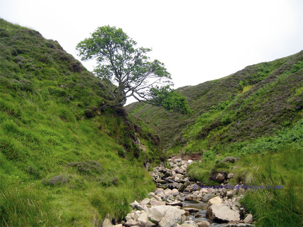
The direction of the way ahead is towards the nick in the hills Harthope Linn is 1Km beyond the sheepfold |
||||||||||||||||||||||||||||||||||||||||||||||||||||||||||||||||||||||||||||||||||||||||||||||||||||||||||||||||||||||||||||||||||
 |
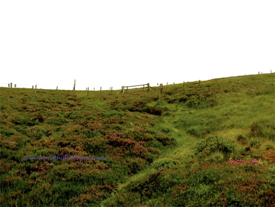
Towards the head of the Harthope Burn the walk makes its way up to the right heading towards the fence which eventually will be seen on the horizon.
I have indicated in the picture below the valley the walk takes to the right |
|
||||||||||||||||||||||||||||||||||||||||||||||||||||||||||||||||||||||||||||||||||||||||||||||||||||||||||||||||||||||||||||||||
 |
||||||||||||||||||||||||||||||||||||||||||||||||||||||||||||||||||||||||||||||||||||||||||||||||||||||||||||||||||||||||||||||||||
 |
 |
|||||||||||||||||||||||||||||||||||||||||||||||||||||||||||||||||||||||||||||||||||||||||||||||||||||||||||||||||||||||||||||||||
 |
 |
|||||||||||||||||||||||||||||||||||||||||||||||||||||||||||||||||||||||||||||||||||||||||||||||||||||||||||||||||||||||||||||||||
|
Having reached the fence don't cross it but staying with the fence on your left set off up Cairn Hill. This is a CLIMB!
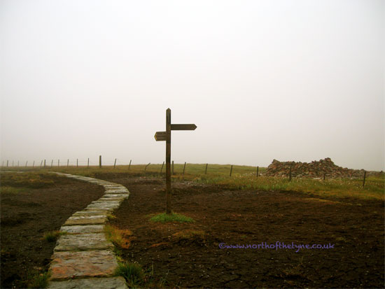
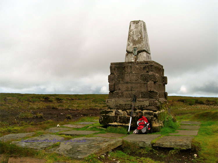
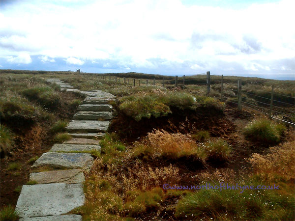
Having reached Scotsman's Cairn for which the hill is named you will find the remarkable pavement leading to the summit cairn of Cheviot on the other side of the border fence and some 1Km away . |
||||||||||||||||||||||||||||||||||||||||||||||||||||||||||||||||||||||||||||||||||||||||||||||||||||||||||||||||||||||||||||||||||
 |
||||||||||||||||||||||||||||||||||||||||||||||||||||||||||||||||||||||||||||||||||||||||||||||||||||||||||||||||||||||||||||||||||
 |
||||||||||||||||||||||||||||||||||||||||||||||||||||||||||||||||||||||||||||||||||||||||||||||||||||||||||||||||||||||||||||||||||
 |
||||||||||||||||||||||||||||||||||||||||||||||||||||||||||||||||||||||||||||||||||||||||||||||||||||||||||||||||||||||||||||||||||
 |
 |
|||||||||||||||||||||||||||||||||||||||||||||||||||||||||||||||||||||||||||||||||||||||||||||||||||||||||||||||||||||||||||||||||
|
To continue the circular walk. continue on along the Pavement and cross the fence over a ladder stile.
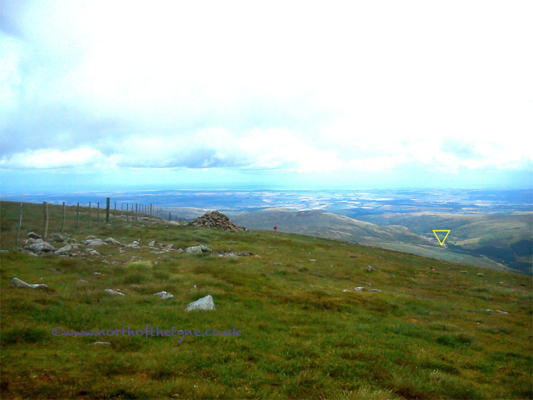
Set off down and left with the fence as a guide. as it levels off after about 2 Km you will be on the ridge of Scald Hill. The fence is still your guide through a gate way and straight on. Where the fence turns left there is a "much weathered " signpost take the pathway to the right. You will see a line of shooting butts. The pathway on the left of the butts offers the easier walking. |
||||||||||||||||||||||||||||||||||||||||||||||||||||||||||||||||||||||||||||||||||||||||||||||||||||||||||||||||||||||||||||||||||
 |
||||||||||||||||||||||||||||||||||||||||||||||||||||||||||||||||||||||||||||||||||||||||||||||||||||||||||||||||||||||||||||||||||
|
I have indicated in this picture where your start point and final destination are, relative to your position at the start of your descent.
|
||||||||||||||||||||||||||||||||||||||||||||||||||||||||||||||||||||||||||||||||||||||||||||||||||||||||||||||||||||||||||||||||||
 |
||||||||||||||||||||||||||||||||||||||||||||||||||||||||||||||||||||||||||||||||||||||||||||||||||||||||||||||||||||||||||||||||||
 |
||||||||||||||||||||||||||||||||||||||||||||||||||||||||||||||||||||||||||||||||||||||||||||||||||||||||||||||||||||||||||||||||||
 |
||||||||||||||||||||||||||||||||||||||||||||||||||||||||||||||||||||||||||||||||||||||||||||||||||||||||||||||||||||||||||||||||||
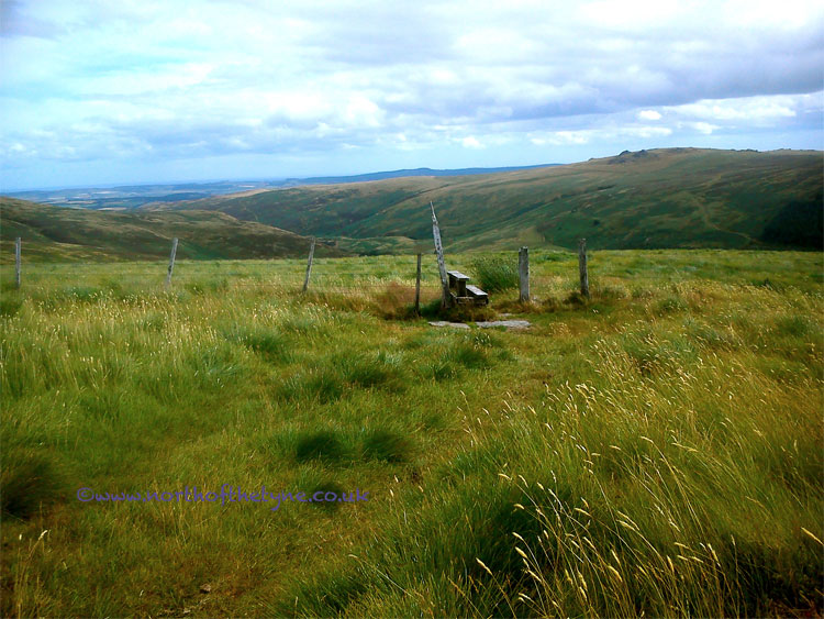 |
Follow this line down the hill it will lead over two stiles back to the to the minor road on which you started. turn left and 500M will see you back at the start. |
|||||||||||||||||||||||||||||||||||||||||||||||||||||||||||||||||||||||||||||||||||||||||||||||||||||||||||||||||||||||||||||||||
 |
||||||||||||||||||||||||||||||||||||||||||||||||||||||||||||||||||||||||||||||||||||||||||||||||||||||||||||||||||||||||||||||||||
|
Notes
When considering this walk You are heading to the highest point in Northumberland so dress accordingly :- Walking boots, Gaiters, Waterproofs. I found my walking poles saved my knees. I set off on a sunny early morning along the burn and at the summit the temperature had dropped 10degC and it was raining, wind speed 35MPH. I was prepared having checked about the weather prospects the night before. Coming down was very hard on my old knees but I passed a number of walkers on my decent on what is the direct route to the top. It looked a long slog to me and I was pleased I had come via the Harthope Burn. Take your OS Map. Cheviot sits in the bottom corner of OS74 |
||||||||||||||||||||||||||||||||||||||||||||||||||||||||||||||||||||||||||||||||||||||||||||||||||||||||||||||||||||||||||||||||||
|
For consideration, when using the countryside
This selection of walks in Northumberland follow recognised public rights of way or permissive paths and should be easy for most people to negotiate: but please remember that wet and winter weather can make paths muddy in places and the summer months produce fresh growth of vegetation - so wear suitable clothing and footwear. If on any of these walks you find obstructions, or damage to stiles or footbridges which make paths impassible, please report these details as soon as possible to the countryside department of the Local or National Park authority responsible for the area. Relationships between local farmers and those who use the footpaths are generally very good and there is no reason why they should not remain so given reasonable attitudes and understanding. Remember that the countryside is the farmers' livelihood, so please observe the Country Code : keep to the paths; close gates after you ; and take care not to cause damage, or leave litter; keep your dog under control; and leave all wild flowers for others to enjoy. Taken from: Country Walks in East Tynedale by Philip R. B. Brooks (1978) NBM Sept 2009 Dogs in the countryside :- On Rights of Way - Dogs must be kept under close control, preferably on a short lead. On Access Land - 1) Keep your dog on a short lead from 1 March to 31 July this to protect ground nesting birds from disturbance 2) Local restrictions may include a ban on dogs. 3) Note that restrictions do not apply to Guide/Hearing dogs, or if you are using a public right of way |
||||||||||||||||||||||||||||||||||||||||||||||||||||||||||||||||||||||||||||||||||||||||||||||||||||||||||||||||||||||||||||||||||

